-
Boat Harbor & Parry's Beach
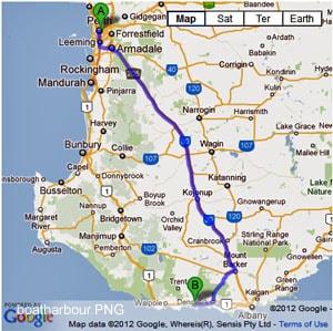
- Boat Harbour rd is 47km east of Walpole and a further 8km in from the highway. The tracks in the area are black sugar sand. Recent improvements made to the Rope Hill track has made access easier. There is no camping at Boat Harbour itself.
- Contact: DPaW Albany 9842 4500


- Nearest service: Denmark or Walpole


- Nearest service: Boat Harbour Chalets


- Nearest service: Parry Beach camp ground


 Windy Harbour
- Distance from Perth: Parrys Beach Camp ground 450km
Distance from Walpole: Boat Harbour rd 47km
Distance from Denmark: Boat Harbour rd 27km - StreetSmart�Travellers Atlas 9th Edition Map: 3 Grid Ref: A 2
- Roads and Tracks Western Australia 2005 Map:1a Grid Ref: F 2
-
Bremer Bay
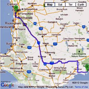
- Bremer Bay offers plenty of actual beach driving, steep access tracks and dune systems to relatively easy bush tracks. Areas to the east of the town could be closed during winter. Access to the Gordon Inlet,Peppermint Beach Tooregullup Beach that are to the east of the town involves crossing the sand bar. The beginning of Gordon Inlet rd starts at the trees area on the other side of the sand bar. The road itself is gravel and eventually runs into a 4wd track that will take you to the Gairdner River mouth.
The river mouth track is quite easy to negotiate. As you proceed along here you will come across a shack, where it is probably a good idea to let your tyres down as continuing further takes you onto the approach track that changes to soft white dune sand with bends and small hills.Reef Beach, Dillion Beach and Fosters are notable fishing spots. - Contact: DPaW Albany 9842 4500 DPaW Parks and Wildlife


- Nearest service: Bremer Bay townsite


- Track Length: 125km
-
 Mary Ann Haven
 - Distance from Perth: Bremer Bay townsite 503km
- StreetSmart�Travellers Atlas 9th Edition Map: 24 Grid Ref: D 3
- Roads and Tracks Western Australia 2005 Map:10a Grid Ref: B 4
-
West Cape Howe and Bornholm Beach
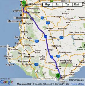
- The track out to Dunksy Beach requires a soft sand hill climb with a "jump-up" at the top. Low clearance vehicles may have trouble (Jan 16). The track into Bornholm is not for the inexperienced. Very low tyre pressures (12lb psi) may be required as the sand is very soft. The area is very steep and the track has consistent woop de doos. When descending keep to the left hand track, as the track has little or no scope to allow two vehicles to pass each other. In a nutshell when you start the descent you may have to go all the way to the bottom enabling you to safely turn around.
- Contact: DPaW Albany 9842 4500 DPaW Parks and Wildlife


 @ Shelley Beach
 - Nearest service: Albany


- Track Length: West Cape Howe 12km Bornholm 11km
 Albany
- Distance from Perth: West Cape Howe(WCH01) 437km
- StreetSmart�Travellers Atlas 9th Edition Map: 4 Grid Ref: B / 3
- Roads and Tracks Western Australia 2005
-
Fitzgerald National Park
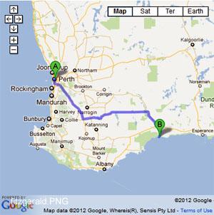
- The tracks in Fitzgerald National Park are easy tracks to negotiate. There are plenty of camping areas near the Hammersley inlet and the eastern entry of the park. Moirs Track is a easy forestry track. There is bitumen rd access to Hamersley Inlet now. Facilities there were under construction at the time (Feb 14).Certain parts of the park will be closed during the winter months. You will find camping at the end of Hammersley Inlet road. Along the Hammersley Inlet rd you will see access to the beach at FTZ71. This track will take you through the Hammersley sand dunes to the beach. It is easier if you let your tyres down as it can be soft in spots. There are a series of posts that will define a path for you to follow. There is also camping at the 4 mile camping area. This is near Barron 's Beach and the eastern entrance (Hopetown end) of the park.
- Contact: DPaW Albany 9842 4500 DPaW Parks and Wildlife
 �
� �
� �
� �
� �
� �@ Four Mile Campground.
 - Nearest service: Hopetown
 �
� �
�
- Track Length: 85km
 �Mary Ann Haven
- Distance from Perth: Hopetown 603 km
West River rd and South Coast Hwy 512km - StreetSmart�Travellers Atlas 9th Edition Map: 44 Grid Ref: C 5
- Roads and Tracks Western Australia 2005 Map:10 10a Grid Ref: A 2
-
Peaceful Bay & the Blue Holes
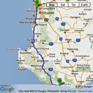
- Peaceful Bay is a small pristine area of the coast with a caravan park & excellent access to the surrounding coastline. The Irwin Inlet is also just down the road. The Blue Holes also known as Bellanger Beach is in the Walpole National Park and offers excellent beach fishing.
- Contact: DPaW Albany 9842 4500


 @ Conspicuous Cliffs
 - Nearest service: Peaceful Bay Caravan Park


 @ Peaceful Bay
 - Track Length: Peaceful Bay 20 km Blue Holes 13 km
 Windy Harbour
- Distance from Perth: Peaceful Bay Caravan Park 446km
- StreetSmart�Travellers Atlas 9th Edition Map: 16 Grid Ref: A 4
- Roads and Tracks Western Australia 2005 Map:1 A Grid Ref: D 2
